Zoom Earth - Live Weather Map


Zoom Earth - Live Weather Map App Info
-
App Name
Zoom Earth - Live Weather Map
-
Package Name
com.neave.zoomearth
-
Developer
Neave Interactive -
Category
Weather -
Updated
2026/04/22
-
Version
6.1
Zoom Earth - Live Weather Map App
Zoom Earth is a cutting-edge app that delivers real-time weather information and maps to users all over the globe. This interactive weather map provides users with live satellite images of the latest storms, wildfires, and other weather phenomena. Whether you're looking to track hurricanes, explore weather forecasts, or simply stay informed about the current conditions in your area, Zoom Earth has you covered.
Features of Zoom Earth - Live Weather Map
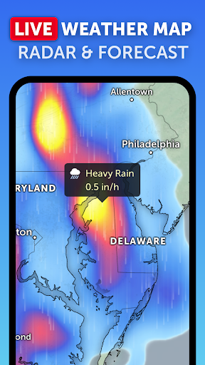
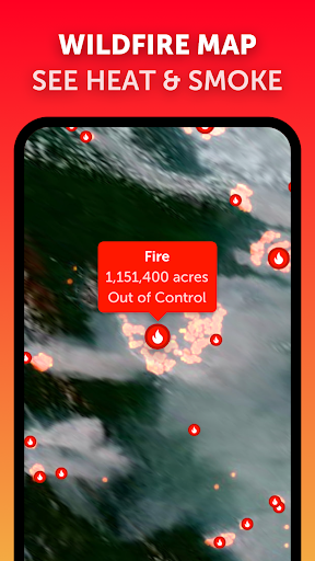
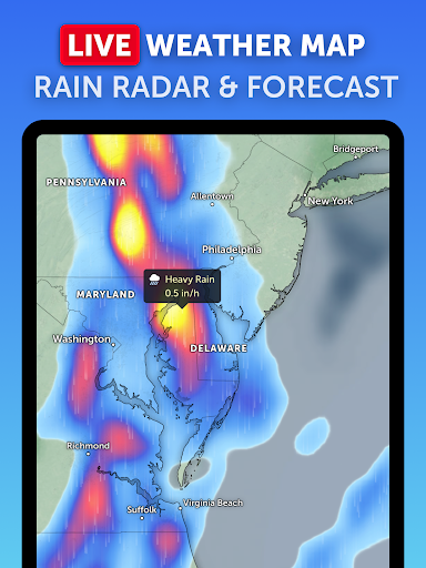
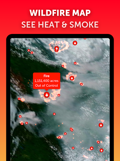
- Live Satellite Images: Zoom Earth offers users access to live satellite images that capture the latest weather events happening around the world. With just a few taps, you can zoom in and explore detailed imagery of storms, wildfires, and other weather patterns.
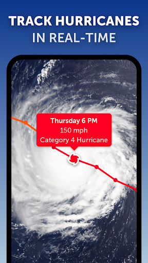
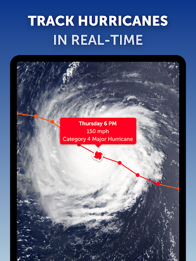
- Real-Time Hurricane Tracker: Stay ahead of the storm with Zoom Earth's real-time hurricane tracker. This feature allows you to track hurricanes as they develop, providing you with up-to-date information on their path and intensity. With this tool, you can make informed decisions and stay safe during hurricane season.
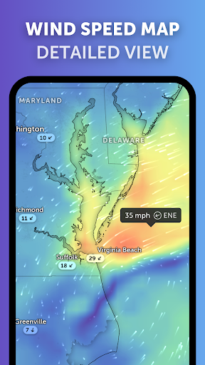
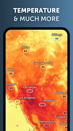
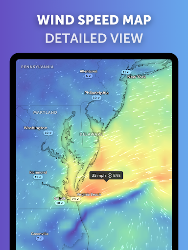
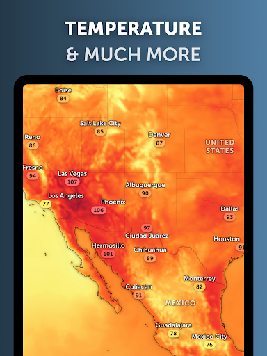
- Weather Forecast Maps: Zoom Earth provides a range of weather forecast maps, including wind, rain, temperature, and pressure. These maps allow you to visualize and understand weather patterns in your location, helping you plan your activities accordingly.
- Customize Your Experience: With Zoom Earth, you can customize your experience by selecting specific layers for your map. Whether you're interested in viewing only earthquakes or wildfires, you can easily tailor the app to display the information that matters most to you.
FAQ
Q: Is Zoom Earth available for both Android and iOS devices?
A: Yes, Zoom Earth is available for both Android and iOS devices. You can download the app from the respective app stores.
Q: How frequently are the satellite images updated?
A: The satellite images on Zoom Earth are updated in near-real-time, providing users with the most current information available.
Q: Can I save and share the satellite images from Zoom Earth?
A: Yes, Zoom Earth allows you to save and share the satellite images directly from the app. This feature is useful for sharing weather updates with friends or on social media.
Editor's Note
Zoom Earth is a comprehensive weather app that combines live satellite imagery and real-time tracking features to provide users with up-to-date weather information. Whether you're a weather enthusiast or simply want to stay informed about current conditions, Zoom Earth offers an intuitive and visually appealing interface for exploring weather patterns around the world. With its customizable features and accurate forecasts, Zoom Earth is a must-have app for anyone interested in staying connected to the weather.